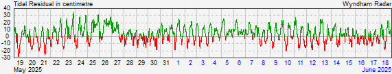
Wyndham
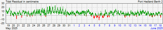
Port Hedland
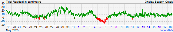
Onslow
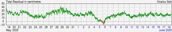
Onslow Salt
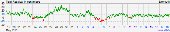
Exmouth
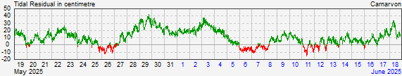
Carnarvon
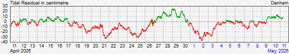
Denham
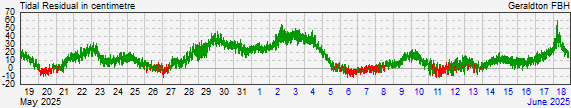
Geraldton Fishing Boat Harbour
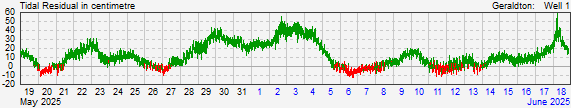
Geraldton Port
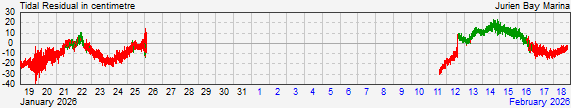
Jurien Bay
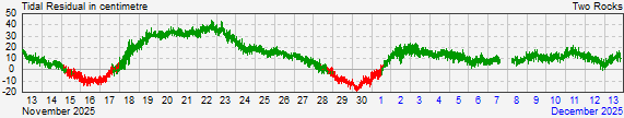
Two Rocks
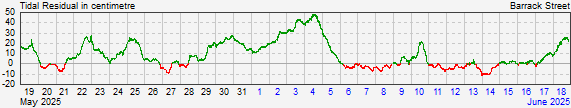
Perth (Barrack St)
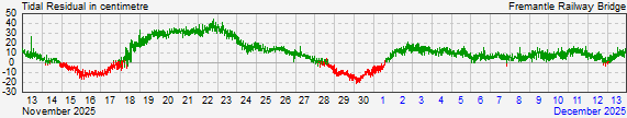
Fremantle Railway Bridge
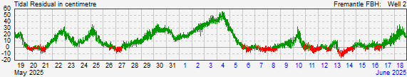
Fremantle Fishing Boat Harbour
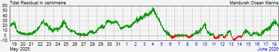
Mandurah
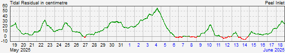
Peel Inlet
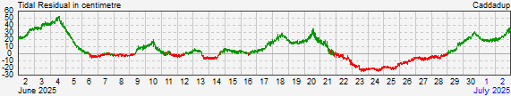
Caddadup
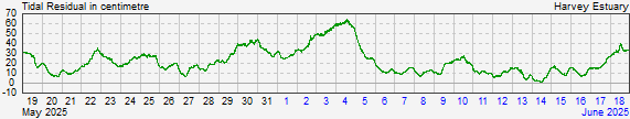
Harvey Estuary
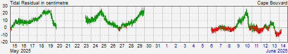
Cape Bouvard
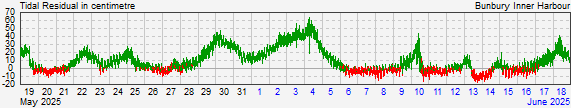
Bunbury Inner Harbour
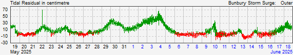
Bunbury Storm Surge Barrier Outer
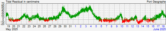
Busselton - Port Geographe
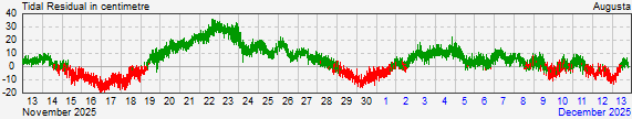
Augusta
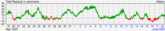
Albany
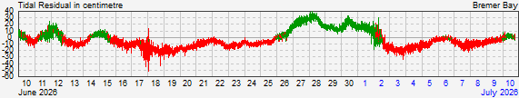
Bremer Bay