About the plan
Central Perth is undergoing the biggest transformation in its development history. With major projects planned or underway it is important we make sure our transport network can support and improve the inner-city experience for everyone.
The Perth Greater CBD Transport Plan (the Plan) seeks to support the continued growth and sustainable development of the Perth Greater CBD as a safe, connected and vibrant city centre. The Plan outlines a series of projects, programs and services needed to keep residents, workers, students and visitors moving within the central area as our city grows.
The Plan provides a framework for state and local governments, key stakeholders and the community to work together to support development of the city’s transport network.
The Plan is being delivered in two phases: an initial five-year program of evidence-based transport priorities and initiatives (Phase One) and a longer-term vision for transport planning in the Perth Greater CBD (Phase Two).
Phase One: Transport priorities
Phase One of the Plan was released in 2020 and delivered a list of agreed transport priorities and initiatives to implement across five years.
Implementation of Phase One is occurring through Inner City Projects where an investment of over $150 million has delivered:
- an enhanced Roe Street
- improved bus stop accessibility, seating and shelter
- upgraded walking and riding infrastructure, including new and improved shared paths and inner city bike paths
- the new Causeway pedestrian and cyclist bridges (Boorloo Bridge)
Phase Two: A vision for future transport investment
Phase Two will see the final Plan released. It will outline transport priorities for the short and long term to support the future development of the Perth Greater CBD towards 2030 and beyond.
The final Plan is currently under consideration.
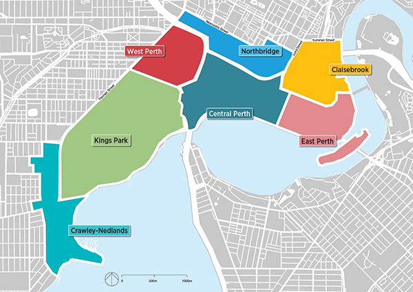
The Perth Greater CBD area
The Perth Greater CBD area refers to the neighbourhoods of Crawley, Nedlands, West Perth, East Perth, Northbridge, Claisebrook and Central Perth and includes Kings Park.