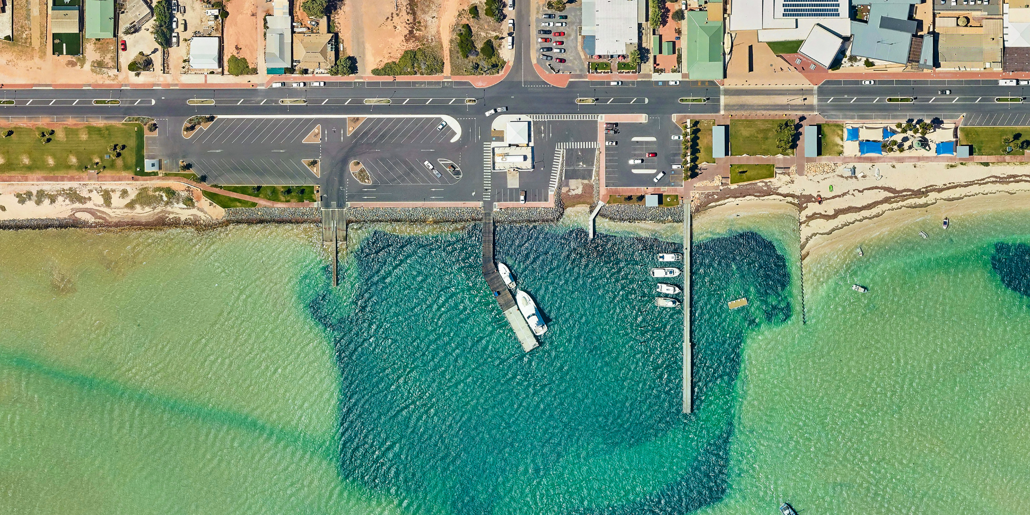
The Denham Maritime Facility is located on the town’s foreshore and services the charter and tourism industry and recreational vessels.
The maritime facility offers service jetty, boat launching and refuelling facilities, and a casual mooring berth. There is also a recreational jetty with six boat pens without walkway.
Denham is the main hub within the Shark Bay Heritage Area, which is renowned for its national parks and beautiful beaches that are home to dolphins, dugongs, and other wildlife.
Facilities
Service jetty
The concrete service jetty has lighting, power, water and fuel.
Wharf load limits
- Commercial vessel berth load: Maximum 50 tonne displacement vessel berthing at a maximum 0.3 m/s at a maximum approach angle of 15°.
- Replica vessel berth load: Maximum 100 tonne displacement vessel berthing at a maximum 0.2 m/s at a maximum approach angle of 15°.
- Crane load: BHB mobilift TC35 (5 tonne crane)
- Stack load: 15kPa (1500kg/m2).
- Mooring load: SWL 10 tonne bollards.
- Vehicle load: M9 vehicle load
Jinker slipway
The slipway is located adjacent to the Service Jetty and is managed by the Shire of Shark Bay.
Recreational jetty
The recreational jetty is located approximately 60 metres south of the service jetty and consists of 6 pens with no walkway.
Boat ramp
There is a dual lane boat launching ramp with a wooden walkway in between. Vehicle and trailer parking are available at the top of the ramp.
Fuelling facility
Diesel fuel is available at this facility. This service is provided by Bailey’s Marine Fuels and a fuel card is required.
Phone: 1300 224 539
Email: baileys@ampol.com.au
Toilets
There is a public toilet block located near the entrance.
Public carparks
There is well maintained car and boat trailer parking located at the entrance to the facility and a carpark is between the service jetty and recreational jetty.
Fish cleaning facilities
There are two fish cleaning facilities, one at the west end of the car and boat trailer parking area and one adjacent to the recreational jetty and pens.
Waterway entrance channel
Latitude: -25.928
Longitude: 113.533
Boat pens
Number of pens
6 pens
Pen lengths
18m fixed pens without walkways
Services
Single phase power and water
Fees and charges (2025/26)
All fees quoted are inclusive of GST and should be paid in advance.
Fixed pen without walkways are charged per metre of the pen length.
Fixed pens without walkways
| Fee description | Amount |
|---|---|
| 12 months | $515.20 |
| 3 months or more per month | $47.00 |
| 1 month | $77.25 |
| 1 week | $23.15 |
Other facility fees
| Fee description | Amount |
|---|---|
| Electricity supply - metered | COST |
| Water supply - metered | COST |
| Rubbish removal - including any not placed in supplied bins or containers not removed; waste oil in excess of 150 litres; or rubbish from source other than fee paying vessel. | COST |
Service jetty fees
There are fees and conditions for use for service jetties and wharves at DTMI managed maritime facilities.
Find out more about service jetty and wharf fees.
Apply for a boat pen
DTMI’s vessel accommodation is offered on a casual, short term and long term basis and is always in high demand. Submit the enquiry form to find out if a pen is available.
Ready to apply?
Once you have spoken with one of our Harbour Officers to confirm availability, fill in either the waitlist or vessel accommodation application form below and familiarise yourself with important terms and conditions.
Weather and conditions
Before heading out on the water, be sure to check the current:
Bureau of Meteorology (BOM) resources:
Useful resources
Cyclone community information sheet
This information sheet provides important information to help users of Denham Maritime Facility during the lead up, impact and recovery from a tropical cyclone.