Welcome to DoTBot, an AI chatbot that the Department of Transport (DoT) is trialling.

DoTBot is designed to answer your questions and help you find information on our website.

Its answers are not legal advice or substitutes for professional advice.

By opening the chatbot you are agreeing to these terms:

  1. DoT cannot guarantee that the information provided by the AI chatbot is error free, complete, and appropriate for your purposes.

  2. You will verify any responses it provides before relying on it.

  3. DoT accepts no liability for any loss, damage or injury resulting from any person's use of the chatbot or reliance on its information.

  4. The chatbot may collect personal information for improving the user experience (see DoT's Privacy Policy). Please avoid sharing Personally Identifiable Information when using this chatbot.

Close
Open DoTBot

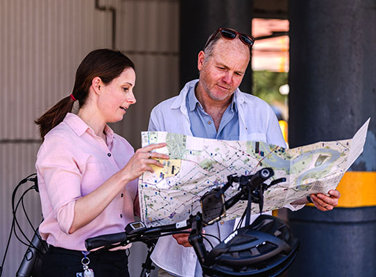
Community active travel maps now available

News for the Department of Transport

20
Dec
2023

Are you impacted by the Armadale train line shut down?

We have a range of maps to help you discover more active and sustainable ways to get around your neighbourhood.

As part of the Department of Transport’s Armadale Line Active Travel project, we are supporting and encouraging locals to consider walking, wheeling and riding, instead of driving for short trips.

The community maps identify walking and bike friendly routes, quiet streets, on-road bicycle lanes and shared paths in and around Armadale, Gosnells, Canning and Victoria Park.

The Department will also be delivering bike education, rider engagement programs and intensive support to 14 schools impacted by the rail closure.

Visit our Armadale Line Active Travel page to access the maps and for more information.   
 

Community maps
 

Page last updated: Wed Dec 20 2023 11:36:25 AM